
Septic System Risk Analysis
LSPA is working on modeling septic system failure risks within the watershed by creating a Septic System Vulnerability Assessment map/tool to share with local towns.
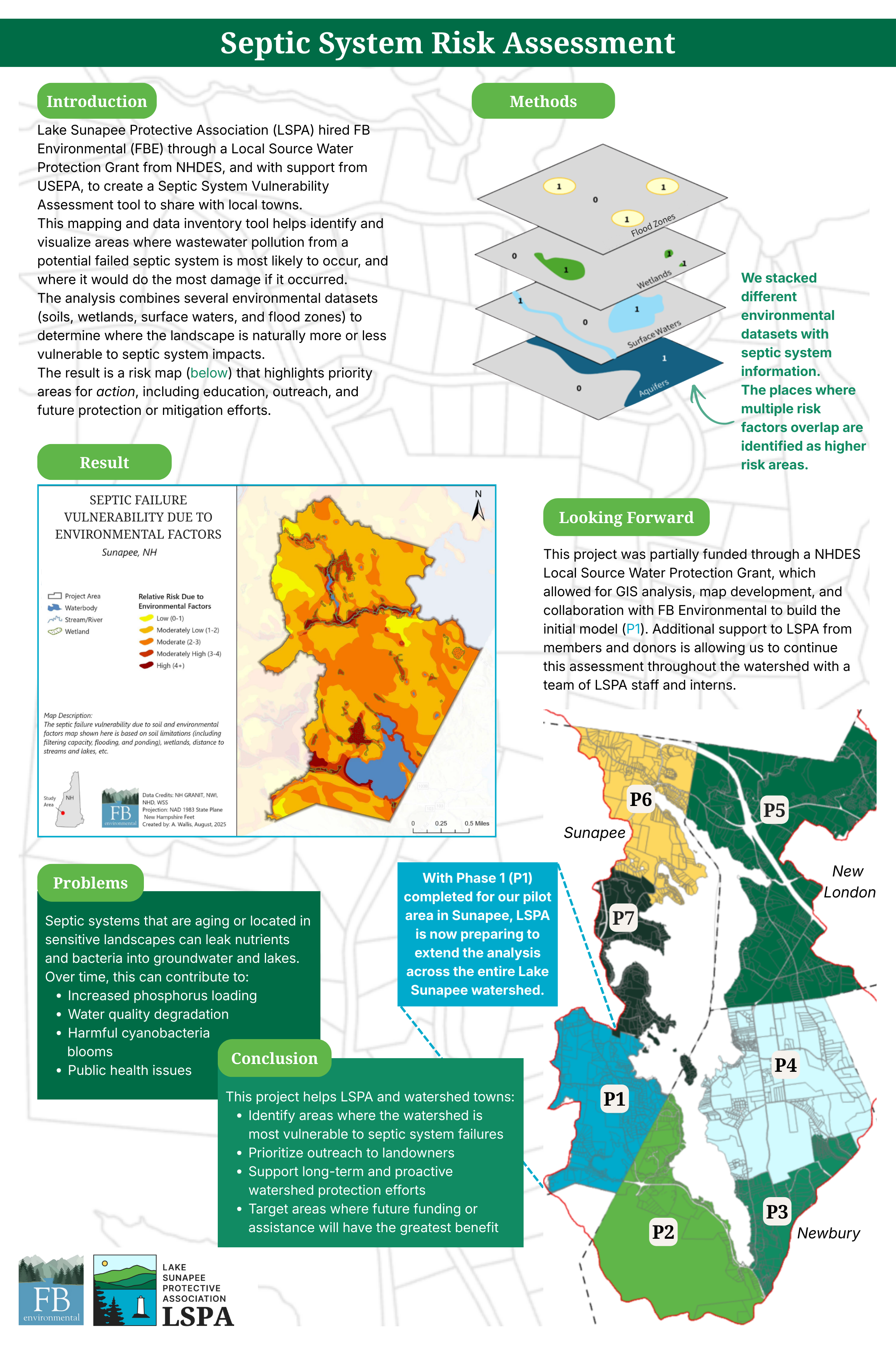
This mapping and data inventory effort helps identify and visualize areas where wastewater pollution from a potential failed septic system is most likely to occur, and where it would do the most damage if it occurred.
The analysis combines several environmental datasets (soils, wetlands, surface waters, and flood zones) to determine where the landscape is naturally more or less vulnerable to septic system impacts. Then, by adding the septic inventory information for each parcel, we can…
Identify areas where the watershed is most vulnerable to septic system failures
Prioritize outreach to landowners
Support long-term and proactive watershed protection efforts
Target areas where future funding or assistance will have the greatest benefit
The result is a risk map (below) that highlights priority areas for action, including education, outreach, and future protection or mitigation efforts.
Read the final report from FBE here, or scroll above.